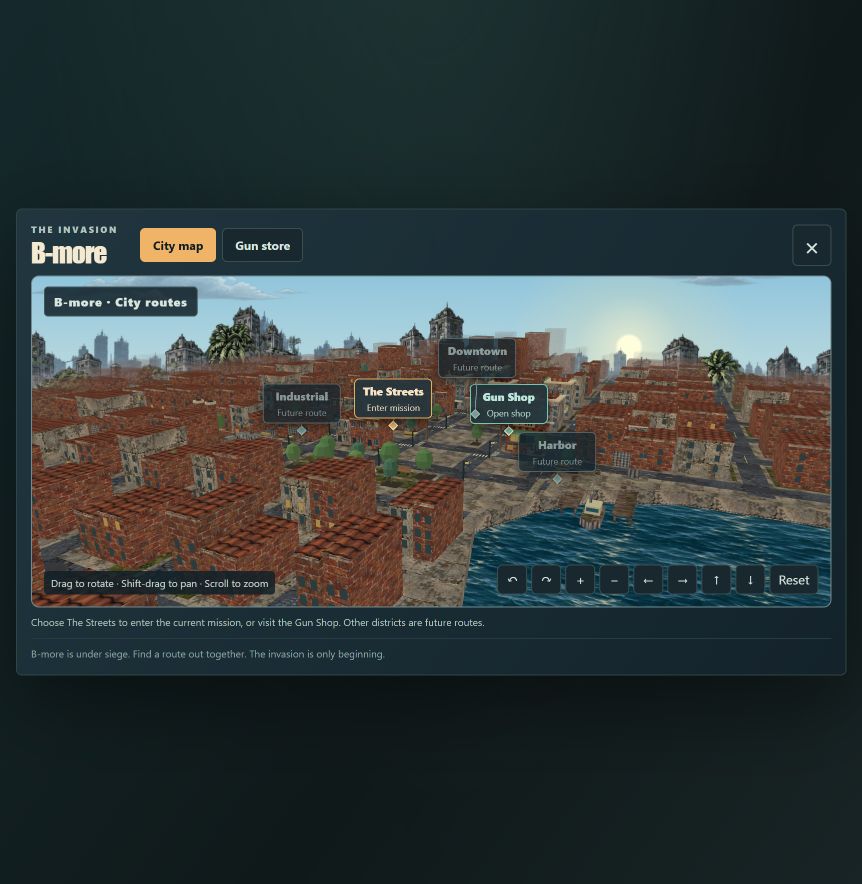
B-more is Baltimore. The city map starts with real street layouts, building footprints, and the waterfront, then brings them into Gruge’s painted game world. The first mission begins on Battery Avenue in Federal Hill.
Start with the actual blocks
The map uses a selected Baltimore extract from OpenStreetMap, captured on October 13, 2026. It includes 1,066 building footprints and named road segments around downtown, the Inner Harbor, and Federal Hill. The update includes smaller rowhouse footprints around Battery Avenue. Pratt Street, Charles Street, Light Street, Lombard Street, and Baltimore Street follow their geographic positions.
The waterfront follows the harbor shoreline rather than a decorative rectangle. Landmark locations include the National Aquarium, World Trade Center, Convention Center, City Hall, Power Plant, Science Center, and Federal Hill.
Give real geography a game treatment
The map combines those positions with the game’s painted bitmap materials. Surface textures, lighting, damaged props, and the vertical scale shape the visual treatment. Building heights use available OpenStreetMap tags; heights without those tags are illustrative. The rendering exaggerates height so buildings read clearly in the game’s elevated view.
Battery Avenue rises beside Federal Hill. Nine elevation estimates from USGS The National Map provide anchors for the local grade. Roads, building bases, and markers follow the interpolated terrain. The hill is a game interpretation of those points, with exaggerated vertical scale; the samples do not form a complete terrain survey.
The mission markers and Gun Shop are fictional gameplay placements. A recognizable city layout provides the setting, while the routes still belong to the zombie game. The current release contains the first mission; future districts remain in development.
Keep the source available
OpenStreetMap contributors created the geographic data. The reduced database used by this map is available as downtown-baltimore.json, with source and derivation notes. Smaller footprints were omitted, redundant polygon vertices were simplified, and the harbor was clipped to the map’s extent.
The geographic database is licensed under ODbL 1.0, with OpenStreetMap attribution. The separate painted game artwork is an original work and is not part of that geographic database license.
Open the B-more map from Pause to see the city behind the first mission.